Blog Details
Satellite Data for Monitoring and Managing Agricultural Land and Crop Health
13 June 2023
Satellite Data for Monitoring and Managing Agricultural Land and Crop Health
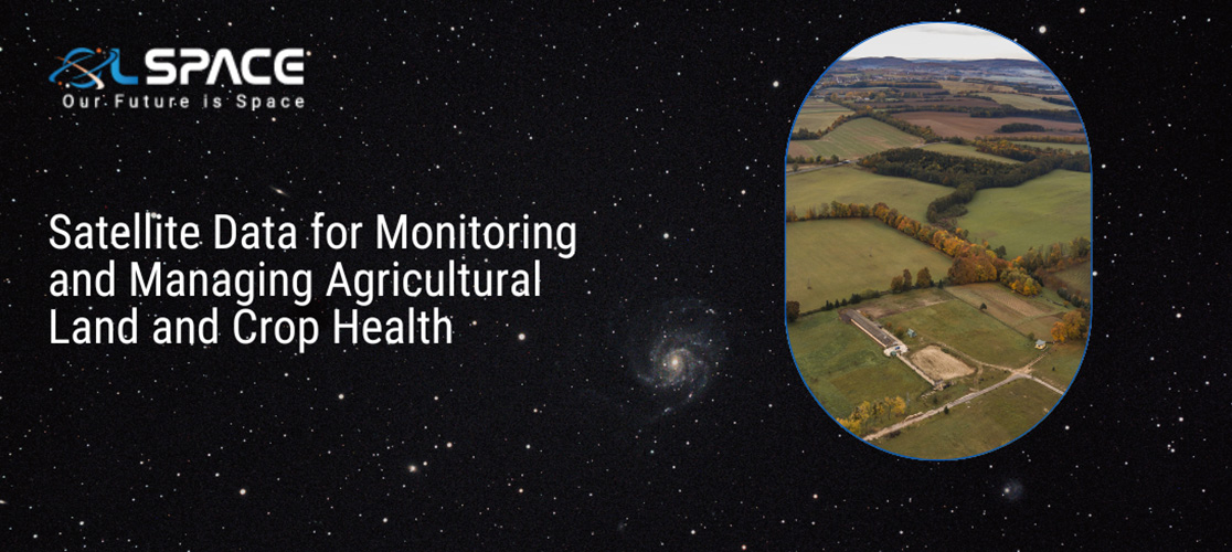
Satellite technology has become a valuable tool in agriculture, offering a wealth of data and insights to monitor and manage agricultural land and crop health. By harnessing satellite imagery and remote sensing techniques, farmers and land managers can obtain critical information about vegetation growth, soil conditions, water availability, and crop health. In this blog post, we will explore the benefits and applications of satellite data in monitoring and managing agricultural land, improving crop yields, and supporting sustainable farming practices.
Crop Monitoring and Yield Prediction: Satellite data provides farmers with real-time information on crop growth and development. By analyzing satellite imagery, farmers can track vegetation indices, such as the Normalized Difference Vegetation Index (NDVI), which indicates plant health and biomass. This data enables farmers to monitor crop growth stages, detect anomalies, and predict yields. By identifying areas of underperforming crops, farmers can take timely action, adjust irrigation, fertilization, or pest management practices, and optimize overall yield.
Soil Mapping and Management: Satellite data aids in soil mapping and monitoring, which is vital for effective soil management. By analyzing multispectral data captured by satellites, farmers can assess soil characteristics, such as organic matter content, moisture levels, and nutrient distribution. This information allows for precision soil management practices, including variable rate fertilization, tailored irrigation scheduling, and targeted soil amendments. Optimal soil management improves nutrient uptake, reduces fertilizer waste, and minimizes environmental impacts.
Water Resource Management: Satellite imagery plays a crucial role in managing water resources in agriculture. Satellites can monitor and analyze vegetation stress levels, which serve as an indicator of water availability and irrigation needs. By assessing crop water requirements and estimating evapotranspiration rates, farmers can optimize irrigation practices, conserve water, and reduce water-related costs. Satellite data also helps identify areas prone to drought stress or waterlogging, allowing for timely intervention and mitigation strategies.
Crop Disease and Pest Monitoring: Satellite imagery combined with advanced analytics techniques can assist in crop disease and pest monitoring. By detecting subtle changes in crop reflectance patterns, satellites can identify early signs of disease outbreaks or pest infestations. Timely detection enables farmers to take preventive measures, such as targeted pesticide application or crop rotation, reducing the risk of crop losses and minimizing the need for broad-scale pesticide use. Satellite data helps farmers adopt more sustainable and integrated pest management practices.
Land Use Planning and Conservation: Satellite data supports land use planning and conservation efforts in agriculture. By monitoring land cover changes, including deforestation, urban encroachment, and soil erosion, satellites help identify areas at risk and support sustainable land management decisions. Satellite imagery can also aid in identifying suitable areas for expansion, optimizing farm boundaries, and managing protected or environmentally sensitive areas. This data-driven approach promotes responsible land use and supports conservation practices.
Agricultural Insurance and Risk Assessment: Satellite data plays a significant role in agricultural insurance and risk assessment. Insurance companies utilize satellite imagery to assess crop health and estimate potential yield losses due to adverse weather events, pests, or diseases. This data helps insurance providers offer customized coverage and expedite claim processes. Farmers can also leverage satellite information to assess risks, improve farm resilience, and make informed decisions regarding crop selection, planting dates, or mitigation measures.
Conclusion: Satellite data has revolutionized the monitoring and management of agricultural land and crop health. By utilizing satellite imagery and remote sensing techniques, farmers can monitor crop growth, assess soil conditions, optimize irrigation, detect disease outbreaks, and support sustainable farming practices. The integration of satellite data into agricultural decision-making processes improves resource efficiency, enhances productivity, and promotes environmentally conscious farming practices. Embracing satellite technology in agriculture enables us to move towards a more sustainable and resilient future for food production.